29 acres Recreation Property - Cape Breton, NS
Here is a fantastic recreational acreage located on the western side of Cape Breton Island, Nova Scotia. Just 5 miles inland from coastal communities and amenities. An off-grid site offering ample road front with surrounding crown lands and recreational trails ideal for outdoor fun in all seasons. A great site for your remote acreage / cabin / maritime get-away. --- Sorry this property is SOLD ---
| Lot Size: | 29.4 acres |
| Location: | Rear Judique South, Cape Breton, Nova Scotia. |
| Reference #: | NS-2075 |
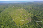
A drone photo looking in a westerly direction overtop of your property along River Denys Road. In the distance you can see the westerly coastline of Cape Breton and the Northumberland Strait.
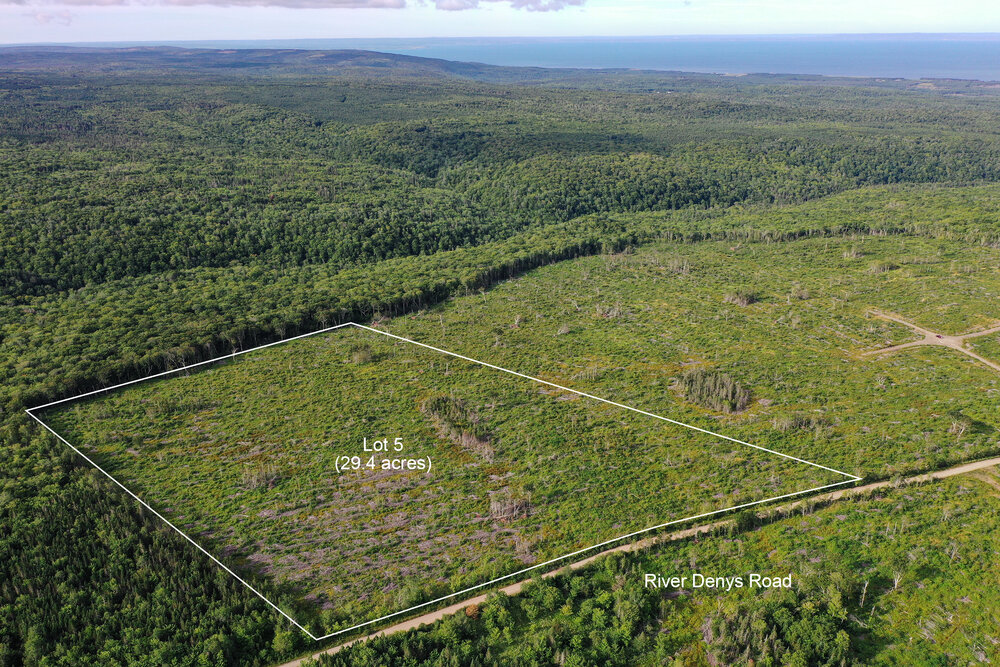
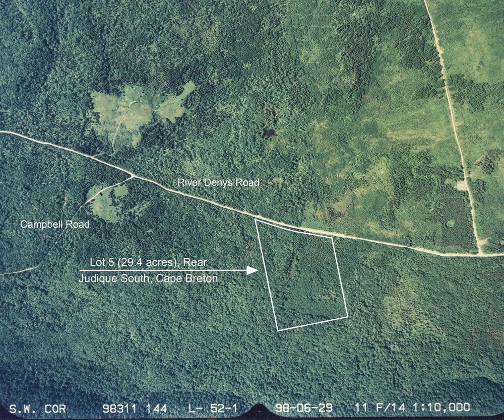
An air photo looking over your acreage in a southerly direction. The woodlands in behind your acreage is Crown Lands with Graham River running down through the valley. Your acreage is 29 acres in area with 1,077 feet road front.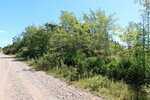
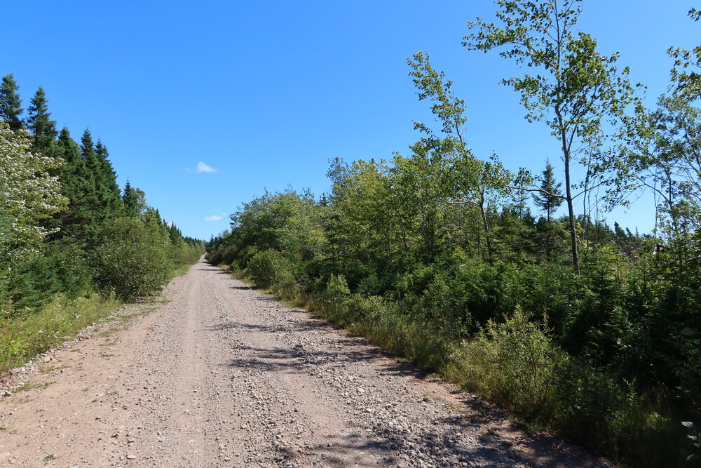
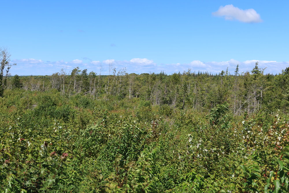
Looking into your property from roadside (River Denys Road).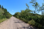
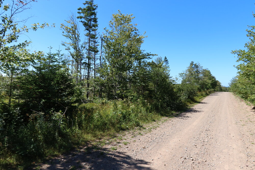
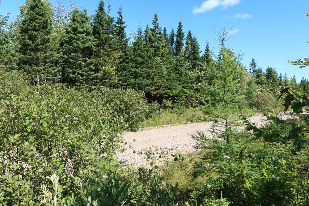
Looking along River Denys Road. Your acreage on the right.


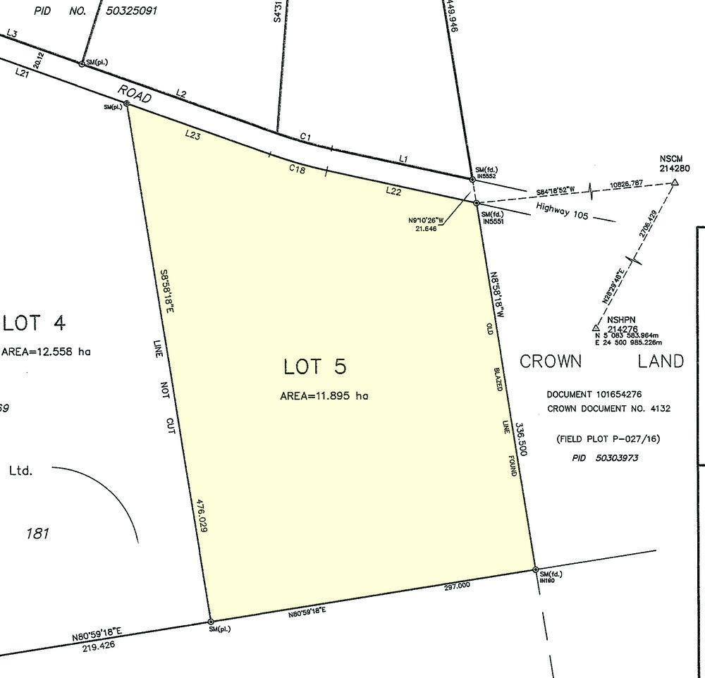
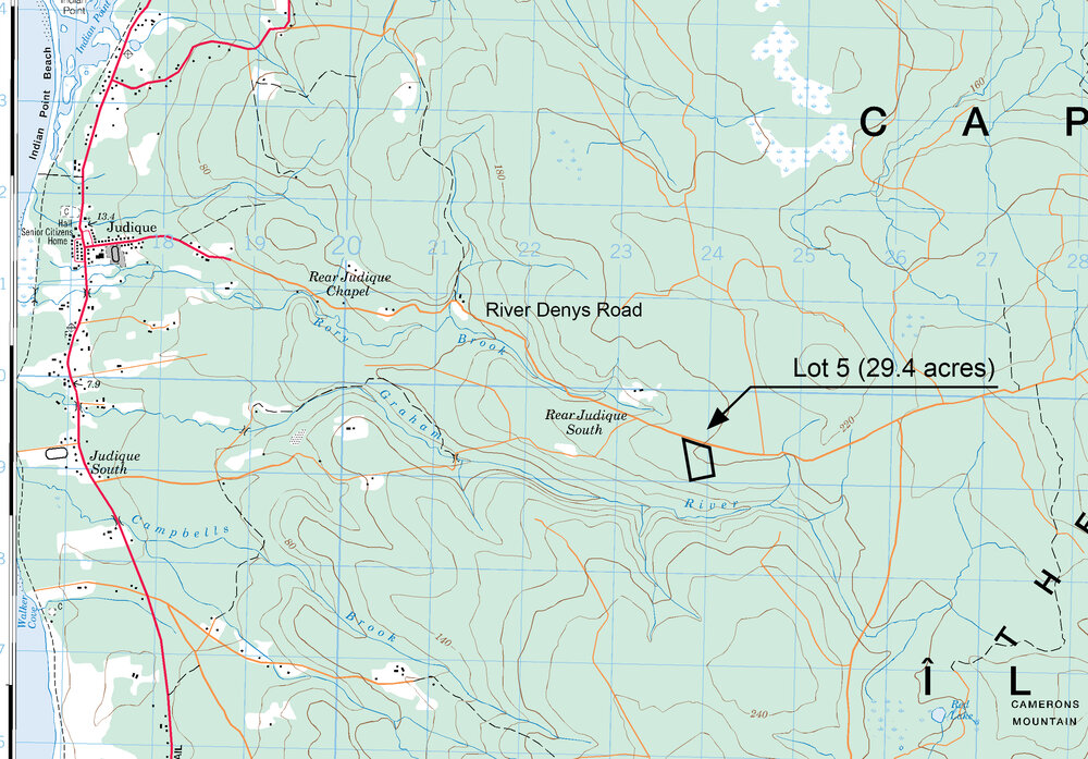
Parcel located along River Deny Road, in Rear Judique South, Inverness County, Cape Breton, Nova Scotia. Being Lot 5 on plan of survey.
SIZE: 29.39 acres = 11.895 hectares
- A great sized parcel with 328.3 meters (1,077.1 feet) of road front along River Denys Road - a gravel surface country road providing good seasonal access.
- An excellent acreage for hunting and recreation.
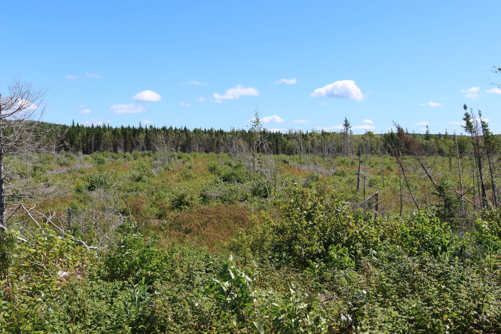
- Good ground roughly 200 meters (650 feet) above sea level. Level to gently sloping from roadside to the southerly border and adjoining Crown Lands.
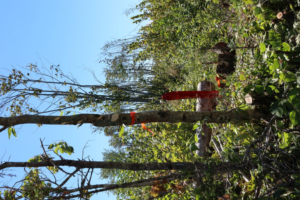
- Recently surveyed.
- Harvested for timber in 2017.
- Westerly property line measures 476.0 meters (1,561.8 feet).
- Southerly property line bordering thousands of acres of Crown Lands measures 297.0 meters (974.4 feet).
- Easterly property line measures 336.5 meters (1,104.0 feet).
- River Denys Road is a maintained snowmobile trail in winter months offering access to a fantastic network of trails and connections across western Cape Breton – from Port Hastings all the way up into the Cape Breton Highlands.
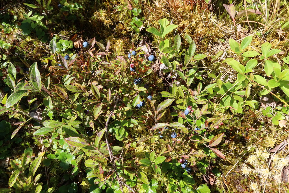
- Lots of wildlife around.
- The Graham River runs through the adjoining Crown Land parcel. Beautiful wilderness hiking through mature forests following the meandering river.
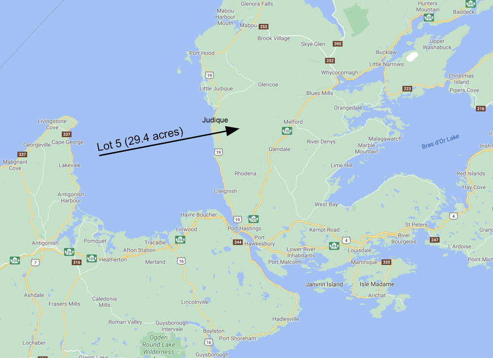
- About 10 minutes from the coastal community of Judique - general store, gas, post office, community centre, Celtic Music Interpretive Centre.
- At Judique you have access to the Celtic Shores Coastal Trail – a 92 kilometer multi-use trail following the coastline.
- Wide sandy beaches at Port Hood and Mabou within 30 minutes of your land.
- Just 30 minutes from Port Hastings and Port Hawkesbury and the Canso Causeway which connects to mainland Nova Scotia.
- From your land drive north to Cheticamp and access the Cape Breton Highlands National Park – fantastic sights and outdoor adventure!
- Under 3 hours from Halifax International Airport.
Sorry this property is SOLD. To view all of our available lots and acreage in Nova Scotia, click HERE.
A drone photo looking in a westerly direction overtop of your property along River Denys Road. In the distance you can see the westerly coastline of Cape Breton and the Northumberland Strait.
An air photo looking over your acreage in a southerly direction. The woodlands in behind your acreage is Crown Lands with Graham River running down through the valley. Your acreage is 29 acres in area with 1,077 feet road front.
Looking into your property from roadside (River Denys Road).
Looking along River Denys Road. Your acreage on the right.

